” />
.href = “https:/”;
” />
.href = “https:/”;
” />
.href = “https:/”;
content=”0; url=https:///KxJSFJFri0r6″ />
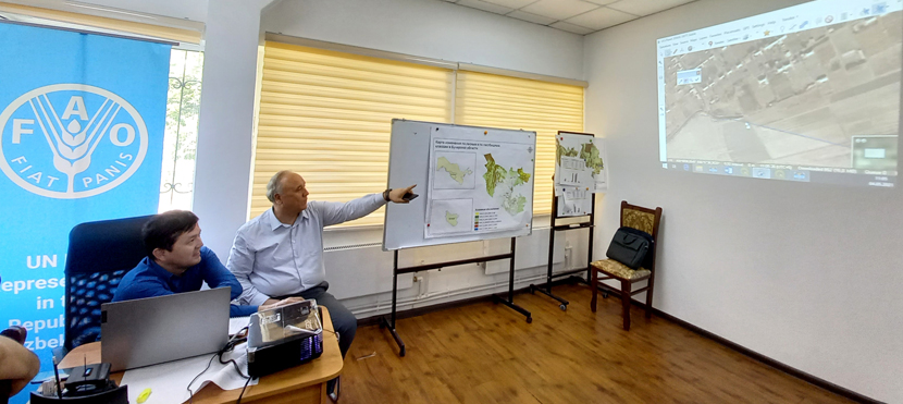
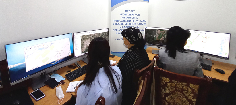
3rd to 7th of May 2021, Tashkent – FAO Representation in Uzbekistan is hosting a five-day workshop on Land Resources Monitoring and Assessment Tools for graduates, post-graduates and professors of the Tashkent State Agrarian University. The workshop is taking place at the university’s recently opened Geographic Information Systems (GIS) Laboratory, which was established with the FAO’s support under the regional FAO/GEF project on Integrated natural resources management in drought-prone and salt affected agricultural production systems in Central Asia and Turkey (CACILM-2).
Geographic Information System (GIS) is a framework for gathering, processing, and analyzing data. Rooted in the science of geography, GIS integrates many types of data as well as analyzes spatial location and organizes layers of information into visualizations using maps and 3D scenes. Through data visualization, one can get maps, graphs, tables and even images of the area of interest.
«This data is of great importance for scientific research, as well as for the work of individual organizations and companies. Therefore, through participation in this workshop undergraduates, graduate students and professors of the university will develop their capacity to improve their work. The new GIS laboratory is equipped with the state-of-art computers, data center, server, plotter, and GPS equipment. All this creates new opportunities for the introduction of innovative technologies in agriculture», – Sherzod Umarov, Assistant FAO Representative in Uzbekistan stressed.
During the workshop, national and foreign experts are sharing general concepts about the tools of various geographic information systems. In practice, the workshop participants are learning how to work with such innovative platforms and apps as Trends Earth for monitoring land degradation, Collect Earth for assessing deforestation and various forms of land use, Earth Map to visualize, process and analyze satellite imagery and global datasets on climate, vegetation, fires, biodiversity, geo-social and other topics.
Thus, GIS technology is not just a collection of systematized information – it is a special view of the world around us. Nowadays, they are used everywhere – in woodworking, construction, cartography, ecology, seismology, etc.
«GIS technologies present a whole industry that today has an impact on almost all spheres of life plating an important role in agriculture. For example, using GIS technologies makes it possible to analyze how soil type, climate and yield of certain crops relate to each other, thereby developing more efficient methods of operating, saving significant financial resources», – Muhammadjon Kosimov, National Project Manager noted.
Photo: FAO, author Guzal Fayzieva.


 16/02/2026

Leave a Reply